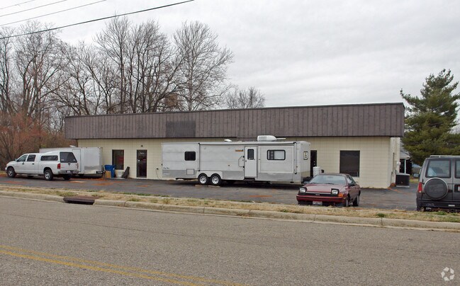
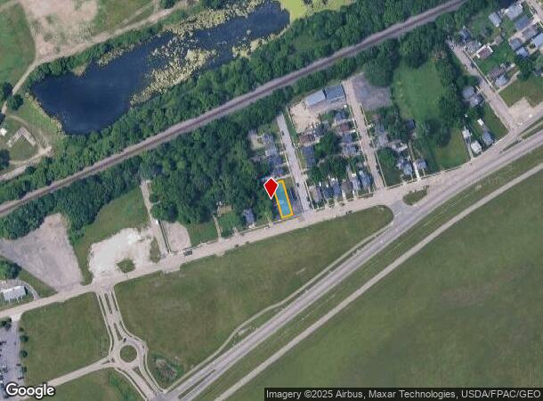
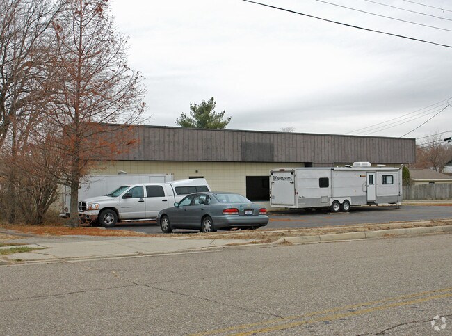
Property Record
5337 Huberville Ave, Dayton, OH 45431
NEARBY LISTINGS FOR SALE OR LEASE
Property Detail
5337 Huberville Ave
Dayton, OH
Riverside Ter
I39-00107-0016
16 RIVERSIDE TER
Officebuilding
Montgomery
X
Ohio
39057C0015D
16
2023
0.09 AC
2024
East Dayton
090600
Cincinnati/Dayton
DEMOGRAPHICS near 5337 Huberville Ave
1 Mile
3 Mile
5 Mile
2024 Total Population
1,755
61,189
182,870
2029 Population
1,720
61,671
184,056
Pop Growth 2024-2029
(1.99%)
+ 0.79%
+ 0.65%
Average Age
35
36
37
2024 Total Households
912
25,171
76,047
HH Growth 2024-2029
(2.08%)
+ 0.93%
+ 0.67%
Median Household Inc
$50,680
$50,811
$52,625
Avg Household Size
1.90
2.30
2.20
2024 Avg HH Vehicles
2.00
2.00
2.00
Median Home Value
$137,500
$121,090
$130,022
Median Year Built
1976
1969
1961
Nearby Places
Map Layers
Map Styles
 Street
 Aerial
- Restaurants
- Banks
- Shops
- Fitness
- Groceries
PUBLIC TRANSPORTATION
AIRPORT
James M Cox Dayton International
DRIVE
WALK
Distance
James M Cox Dayton International
24 min
14.9 mi
Nearby Properties
Address
Land Use
TOTAL SIZE
Lot Size
Zoning
Address
Land Use
TOTAL SIZE
Lot Size
Zoning
132,168 SF
128 AC
PD1
Address
Land Use
TOTAL SIZE
Lot Size
Zoning
259,051 SF
13.39 AC
Address
Land Use
TOTAL SIZE
Lot Size
Zoning
289,136 SF
69.81 AC
R2
Address
Land Use
TOTAL SIZE
Lot Size
Zoning
316.77 AC
Address
Land Use
TOTAL SIZE
Lot Size
Zoning
33,504 SF
14 AC
Address
Land Use
TOTAL SIZE
Lot Size
Zoning
133.37 AC
Address
Land Use
TOTAL SIZE
Lot Size
Zoning
88,522 SF
12.96 AC
Address
Land Use
TOTAL SIZE
Lot Size
Zoning
46,796 SF
53.05 AC
RPUD038
Address
Land Use
TOTAL SIZE
Lot Size
Zoning
54.85 AC
Address
Land Use
TOTAL SIZE
Lot Size
Zoning
136,572 SF
5.59 AC
CPUD055
Address
Land Use
TOTAL SIZE
Lot Size
Zoning
46.32 AC
Address
Land Use
TOTAL SIZE
Lot Size
Zoning
32.30 AC
Address
Land Use
TOTAL SIZE
Lot Size
Zoning
111,938 SF
10.03 AC
Address
Land Use
TOTAL SIZE
Lot Size
Zoning
2,376 SF
18.75 AC
PD1
Address
Land Use
TOTAL SIZE
Lot Size
Zoning
18,087 SF
19.69 AC
Address
Land Use
TOTAL SIZE
Lot Size
Zoning
96,732 SF
6.73 AC
CPUD002
Address
Land Use
TOTAL SIZE
Lot Size
Zoning
18,576 SF
11.66 AC
Address
Land Use
TOTAL SIZE
Lot Size
Zoning
94,608 SF
7.44 AC
Address
Land Use
TOTAL SIZE
Lot Size
Zoning
45,954 SF
9.46 AC
Address
Land Use
TOTAL SIZE
Lot Size
Zoning
9,216 SF
16.77 AC
RPUD891
Address
Land Use
TOTAL SIZE
Lot Size
Zoning
23.20 AC
Address
Land Use
TOTAL SIZE
Lot Size
Zoning
1,200 SF
4.25 AC
B3
Address
Land Use
TOTAL SIZE
Lot Size
Zoning
Address
Land Use
TOTAL SIZE
Lot Size
Zoning
22.70 AC
Address
Land Use
TOTAL SIZE
Lot Size
Zoning
89,082 SF
4.61 AC
Address
Land Use
TOTAL SIZE
Lot Size
Zoning
101,262 SF
10.83 AC
Address
Land Use
TOTAL SIZE
Lot Size
Zoning
81,978 SF
3.64 AC
CPUD055
Address
Land Use
TOTAL SIZE
Lot Size
Zoning
19,008 SF
19.96 AC
PD1
Address
Land Use
TOTAL SIZE
Lot Size
Zoning
9,840 SF
8.83 AC
PD1
Address
Land Use
TOTAL SIZE
Lot Size
Zoning
11.58 AC
The World's #1 Commercial Real Estate Marketplace
Connect with us
© 2025 CoStar Group
The information above has been obtained from sources believed reliable. While we do not doubt its accuracy we have not verified it and make no guarantee, warranty or representation about it. It is your responsibility to independently confirm its accuracy and completeness. Any projections, opinions, assumptions, or estimates used are for example only and do not represent the current or future performance of the property. The value of this transaction to you depends on tax and other factors which should be evaluated by your tax, financial, and legal advisors. You and your advisors should conduct a careful, independent investigation of the property to determine to your satisfaction the suitability of the property for your needs.